Heute sollte es sein. Der Wetterbericht hat sich nicht groß geändert. Aprilwetter nur ohne Hagel, Schnee und Graupel. Doch ich wollte mein Glück probieren. Die Wolken über Puerto Cruz hingen am frühen Morgen um 7 Uhr recht tief. Ich hatte die Hoffnung, dass sie sich im Süden verziehen, und dass es nicht regnen wird.
It was supposed to be today. The weather forecast hasn’t changed much. April weather only without hail, snow and sleet. But I wanted to try my luck. The clouds over Puerto Cruz hung quite low in the early morning at 7am. I hoped that they would move and that it would not rain.
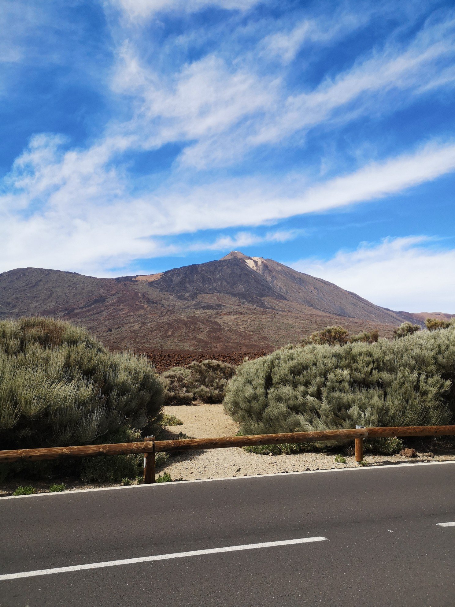
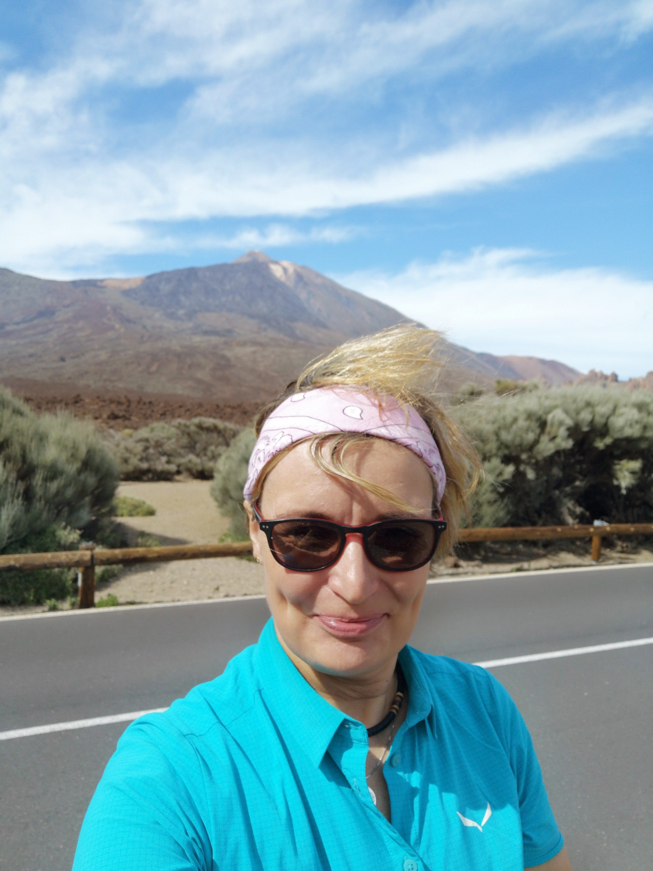
Ich wollte meine Tour in Vilaflor starten, ein kleines Bergdorf in den Canadas. Dort wo auch der Teide steht. Kurz nach 8 fuhr ich los, weil ich annahm, dass ich es in 1,5 h schaffen werde. Aber Googlemaps war der Meinung, mich diverse Abkürzungen zu schicken, steil den Berg hinauf und wieder hinunter. Nein danke. Ich fuhr wie ich das für richtig empfand und kam auch ans Ziel, aber erst nach 2 h. Je höher ich kam, wurde es anfangs immer dunkler. Ich fuhr durch Nebelbänke und Regenwolken. Zurück? Nö! Und ich tat gut daran. Plötzlich rissen die Wolken auf, blauer Himmel – Endlich!!! Aufschrei! Huch, was ist denn das? Der Teide direkt vor mir. Mir war nicht bewusst, dass die Route über den Teide-Nationalpark ging und so dicht an ihm vorbei. Und da strahlte er im Sonnenschein, strahlend blauer Himmel. Kurz wurde ich fast schwach und blinkte schon an der Einfahrt zur Talstation der Teleferico. Ach nein! Warum? Von da oben sieht man auch nicht mehr als Wolken. Und bis zum Krater darf man nur mit Genehmigung. Nein, nur um nach oben zu fahren, um Nichts zu sehen?! Ist mir das Geld zu schade. Und da jetzt die Sonne scheint, hatte ich die Hoffnung, dass auch in Vilaflor (ca 2000 Hm) die Sonne scheint.
I wanted to start my tour in Vilaflor, a small mountain village in the Canadas. It’s also where the Teide is. I set off shortly after 8am, assuming that I would make it in 1.5 hours. But Googlemaps thought it would send me on various shortcuts, steeply up and down the mountain. No thanks. I rode as I saw fit and reached my destination, but only after 2 hours. The higher I got, the darker it became at first. I drove through banks of fog and rain clouds. Back? Nope! And I did well to do so. Suddenly the clouds broke, blue sky – Finally!!! Scream! Oops, what’s that? The Teide right in front of me. I wasn’t aware that the route went over the Teide National Park and so close to it. And there it was, shining in the sunshine, a brilliant blue sky. I almost fainted for a moment and was already blinking at the entrance to the valley station of the Teleferico. Oh no! Why? From up there you can’t see more than clouds. And you can only get to the crater with a permit. No, just to go up and see nothing?! It’s not worth the money. And now that the sun is shining, I had hoped that the sun would also shine in Vilaflor (approx. 2000 m altitude).
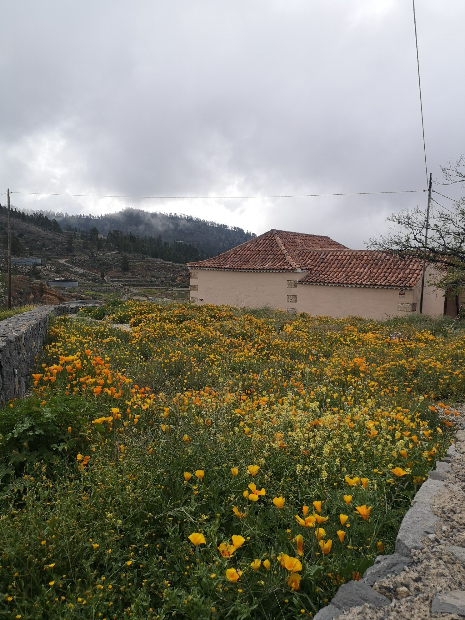
Aber dem war nicht so. Ich fuhr eine gut ausgebaute Straße in Richtung Süden, nach ca 20 km kam ich an und fand mich in Wolken wieder. Aber wenigstens regnete es nicht. Es war nur etwas kalt. Mein Kopf brummte – 2000 Hm von Null. Das kann ja heiter werden. Schnappatmung vorprogrammiert. Es legte sich aber recht bald.
But that was not the case. I drove a well-built road south, after about 20 km I arrived and found myself in clouds. But at least it wasn’t raining. It was just a bit cold. My head was buzzing – 2000 m from zero. This is going to be fun. Breathlessness preprogrammed. But it subsided quite soon.
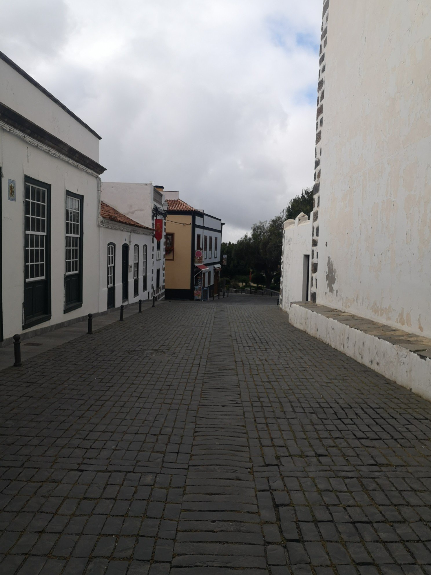
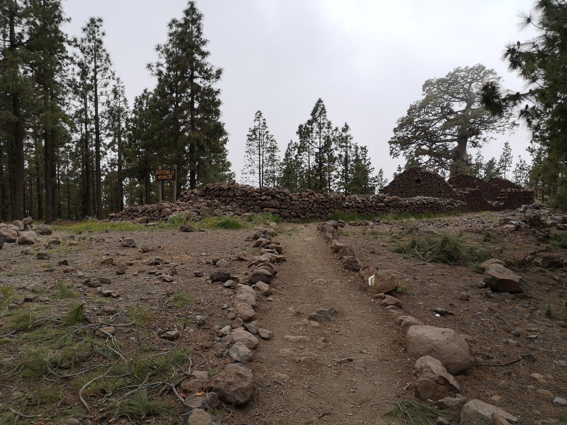
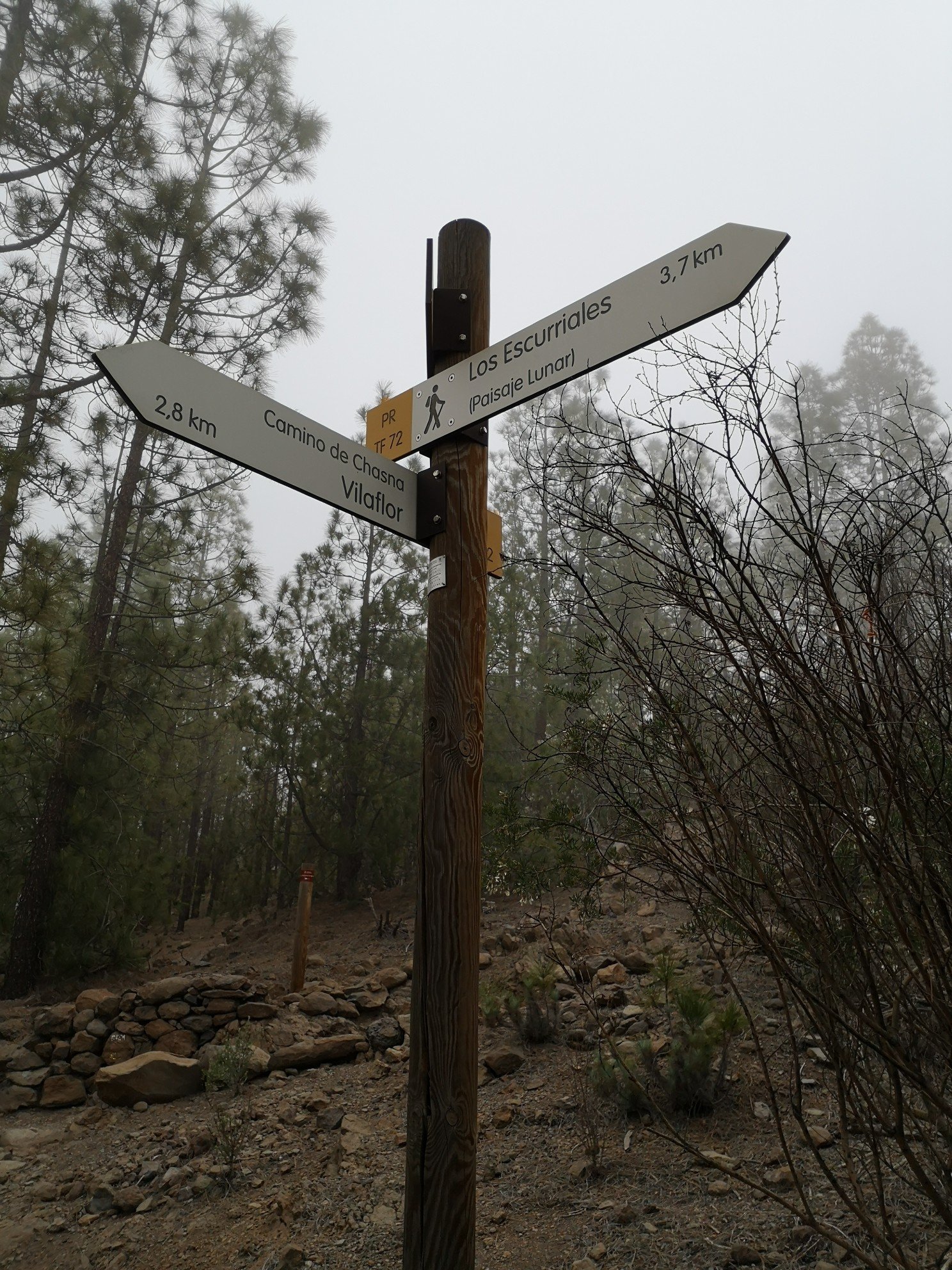
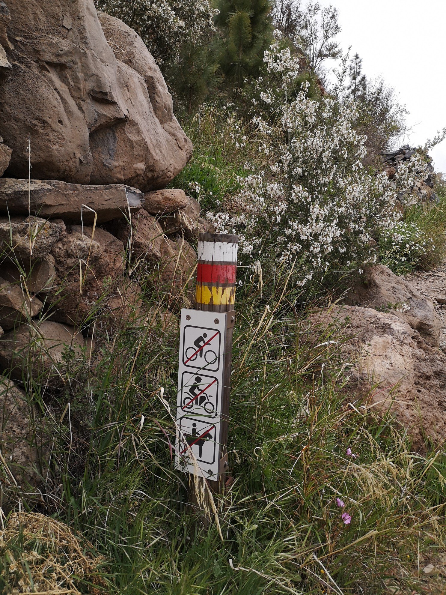
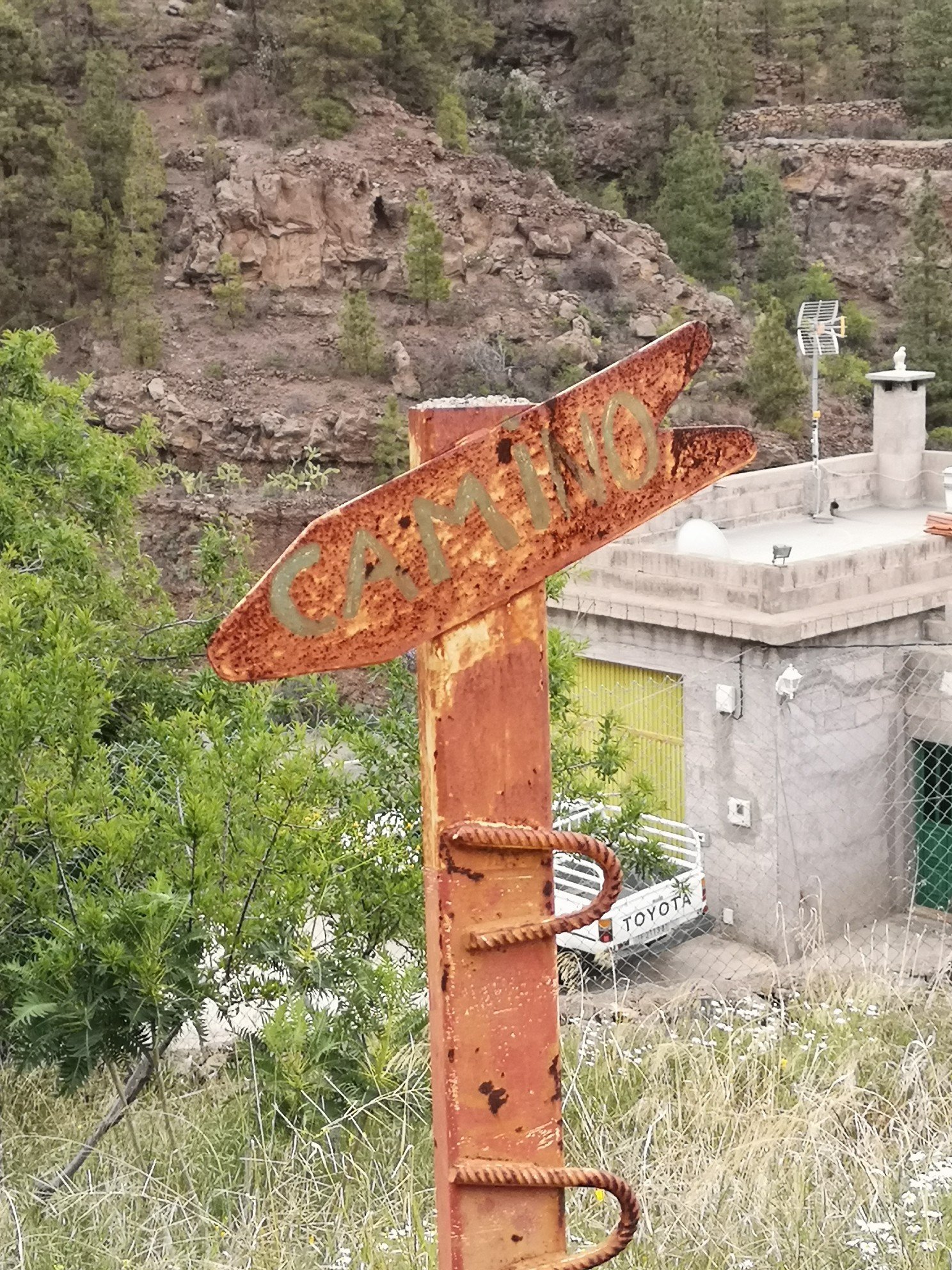
Es begann dann erst einmal eine Schnitzeljagd: Wo ist der richtige Camino zum Ziel? Ich verließ mich auf drei Quellen: den Rother Wanderführer, die Ausschilderung, und letztendlich auf GPS. Keines von allen dreien brachte mich dahin, wohin ich wollte. Ich irrte durch den Ort, die Straße wieder hinaus, übers Feld und landete immer wieder in einer Sackgasse. Ich wurde wütend und fragte mich, wozu das alles. Zwei Stunden Anfahrt, um den Weg nicht zu finden??? Aber aufgeben geht nicht. Meiner Sturheit und Ehrgeiz ist zu verdanken, dass ich mich nicht mehr auf Buch und GPS verließ und versuchte, die Ausschilderung zu verstehen. Und dann war es passiert. Ich fand mich plötzlich bäuchlings auf dem Camino wieder. Nichts Schlimmes! Nichts kaputt gegangen. Paar blaue Flecke, Knie war aufgeschlagen. Schmerz oder Wut! Ich kann es bis jetzt nicht beschreiben. Ich gab trotzdem nicht auf. Nun erst recht. Völlig verstaubt zog ich einfach weiter.
Then a scavenger hunt began: Where is the right Camino to the destination? I relied on three sources: the Rother hiking guide, the signposting, and finally on GPS. None of the three got me where I wanted to go. I wandered through the village, out the road again, across the field and kept ending up in a dead end. I got angry and asked myself what the point was. Two hours of travelling to not find the way??? But giving up was not an option. Thanks to my stubbornness and ambition, I stopped relying on the book and GPS and tried to understand the signposts. And then it happened. I suddenly found myself belly-down on the Camino. Nothing bad! Nothing broken. A couple of bruises, knee was banged up. Pain or anger! I can’t describe it yet. I still didn’t give up. Now more than ever. Completely dusty, I just moved on.
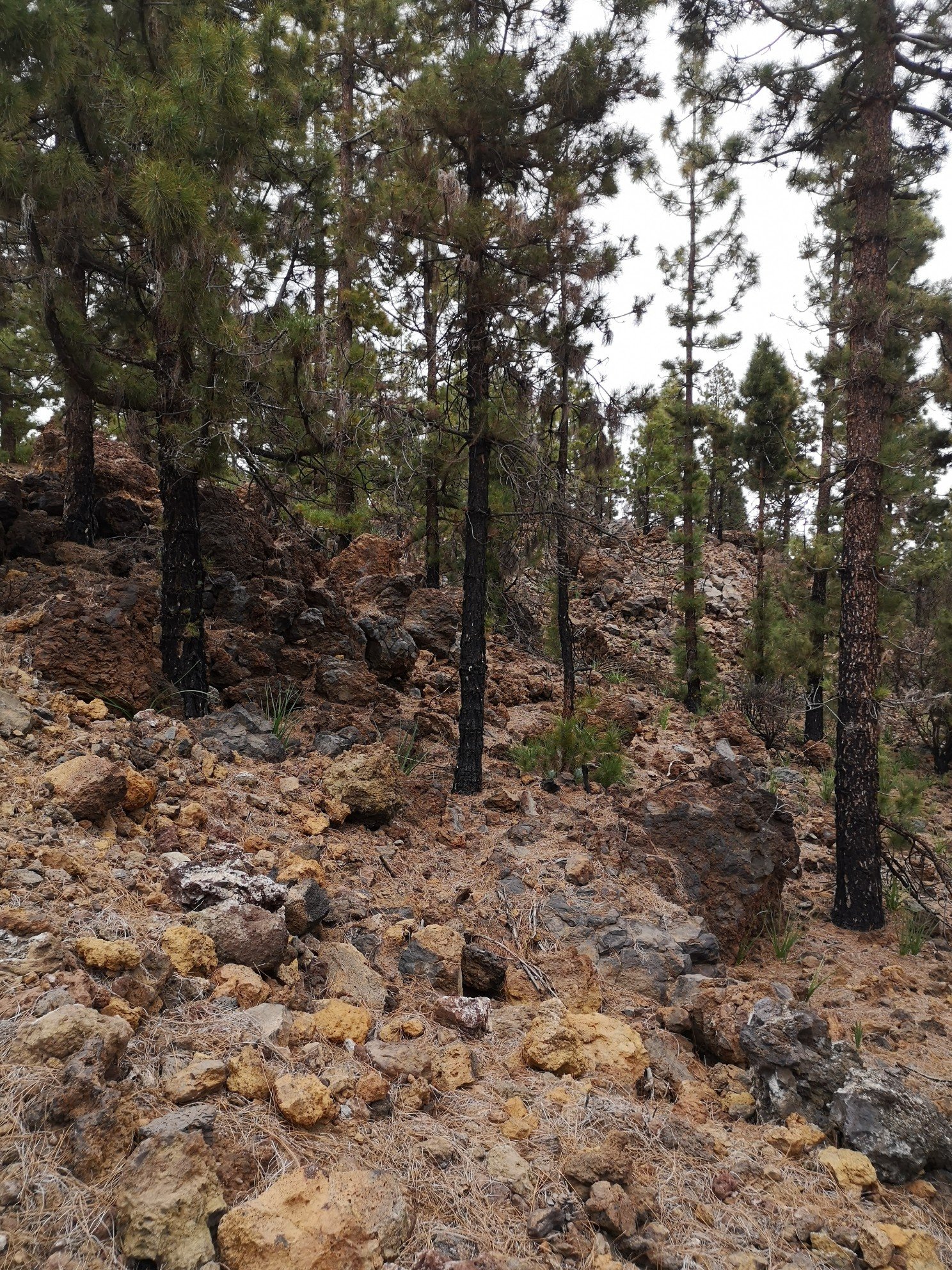
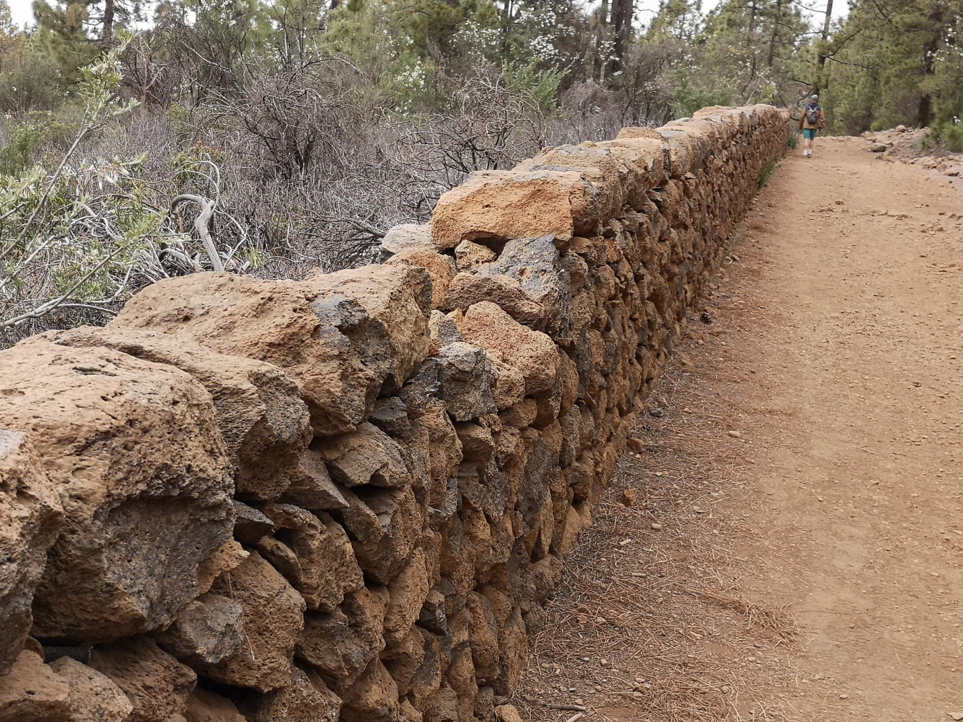
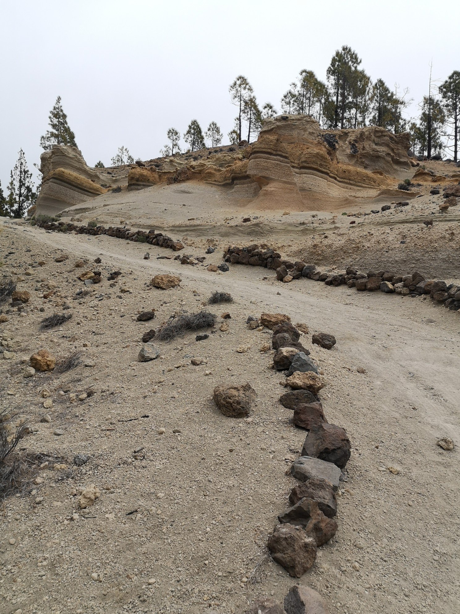
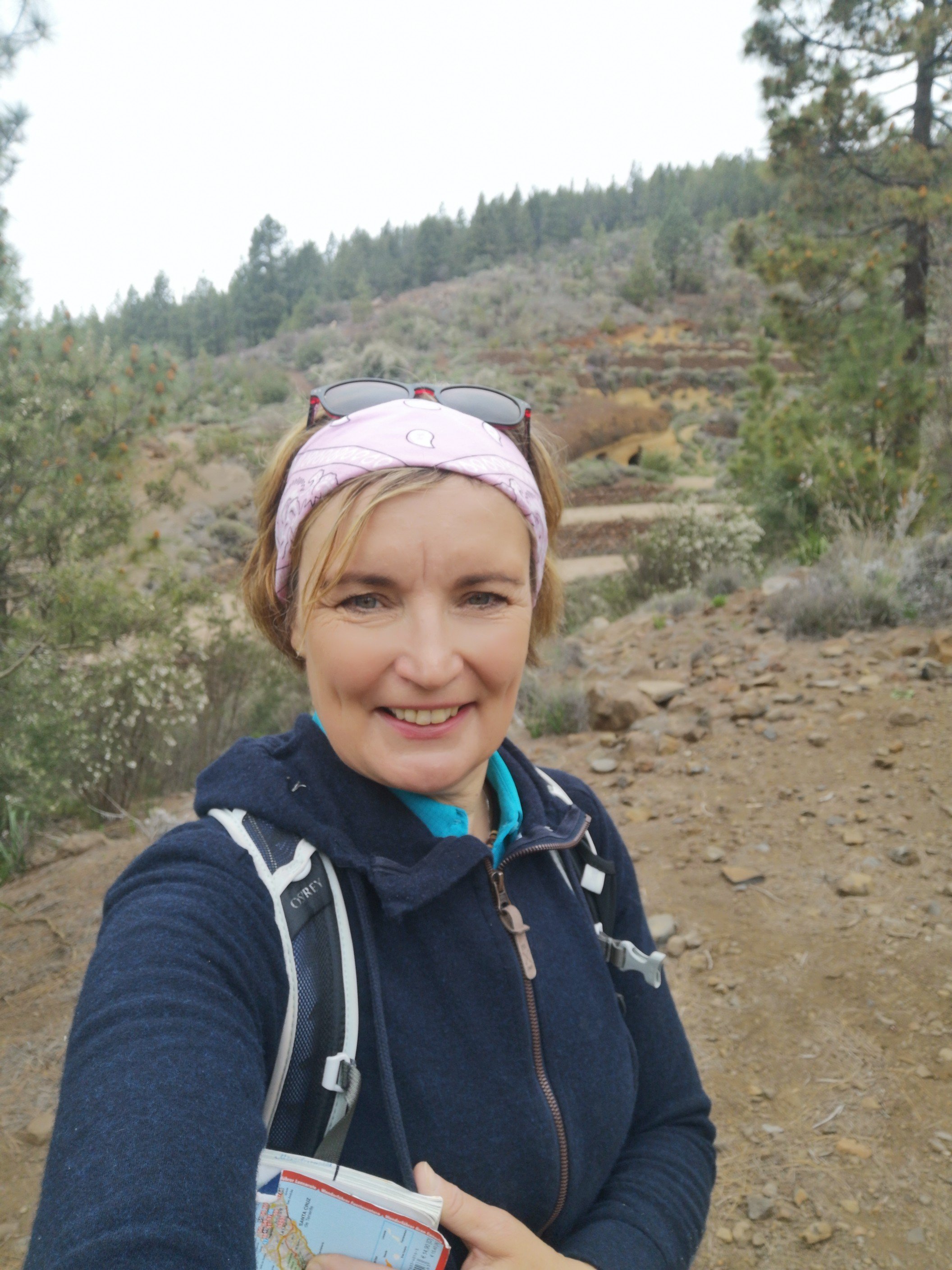
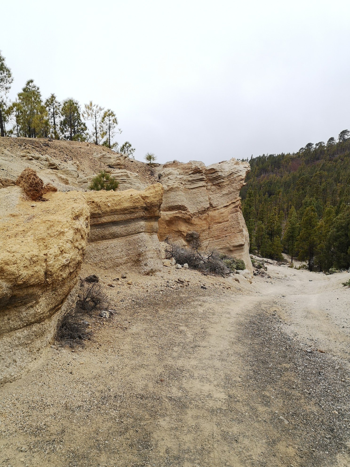
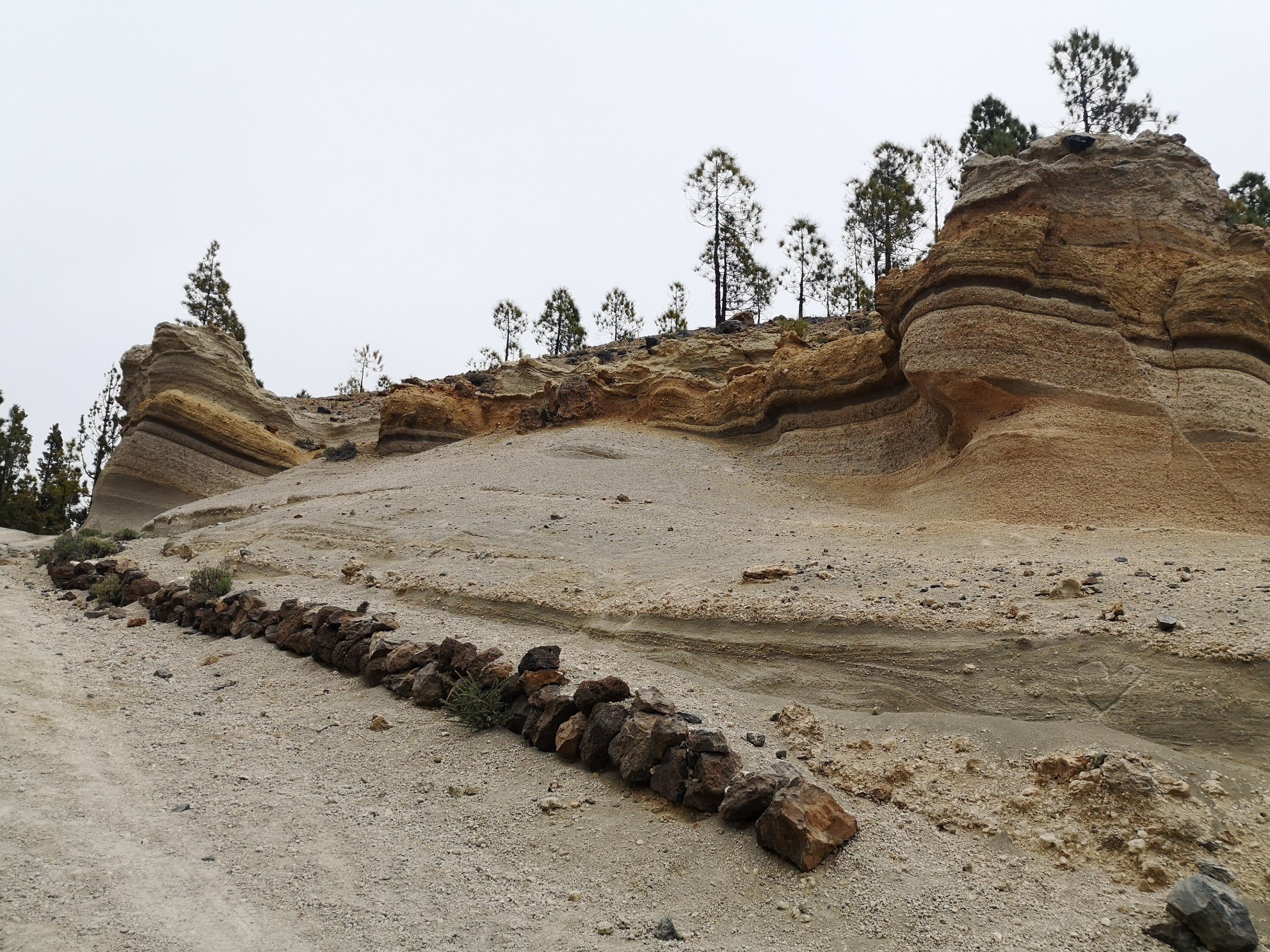
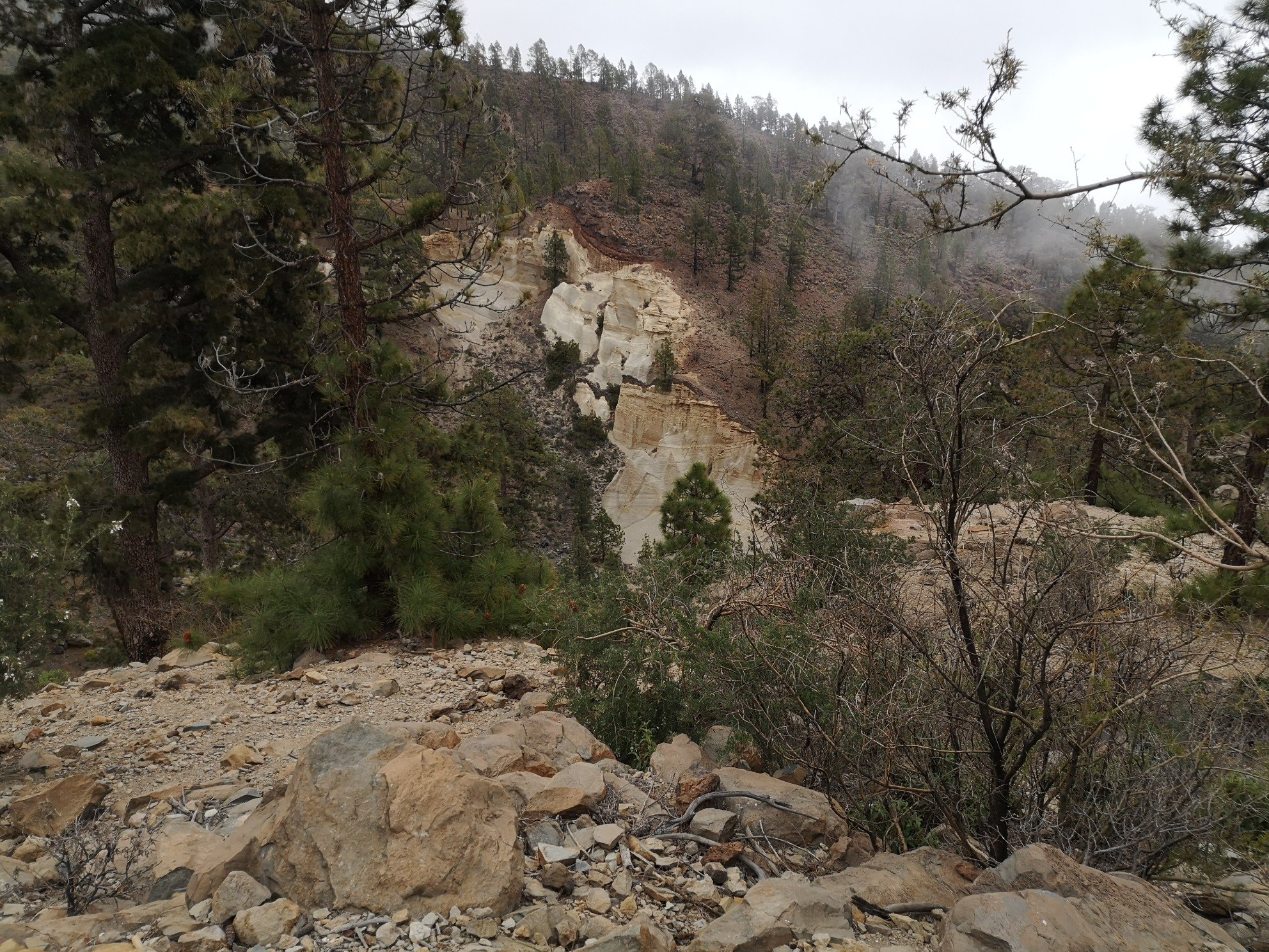
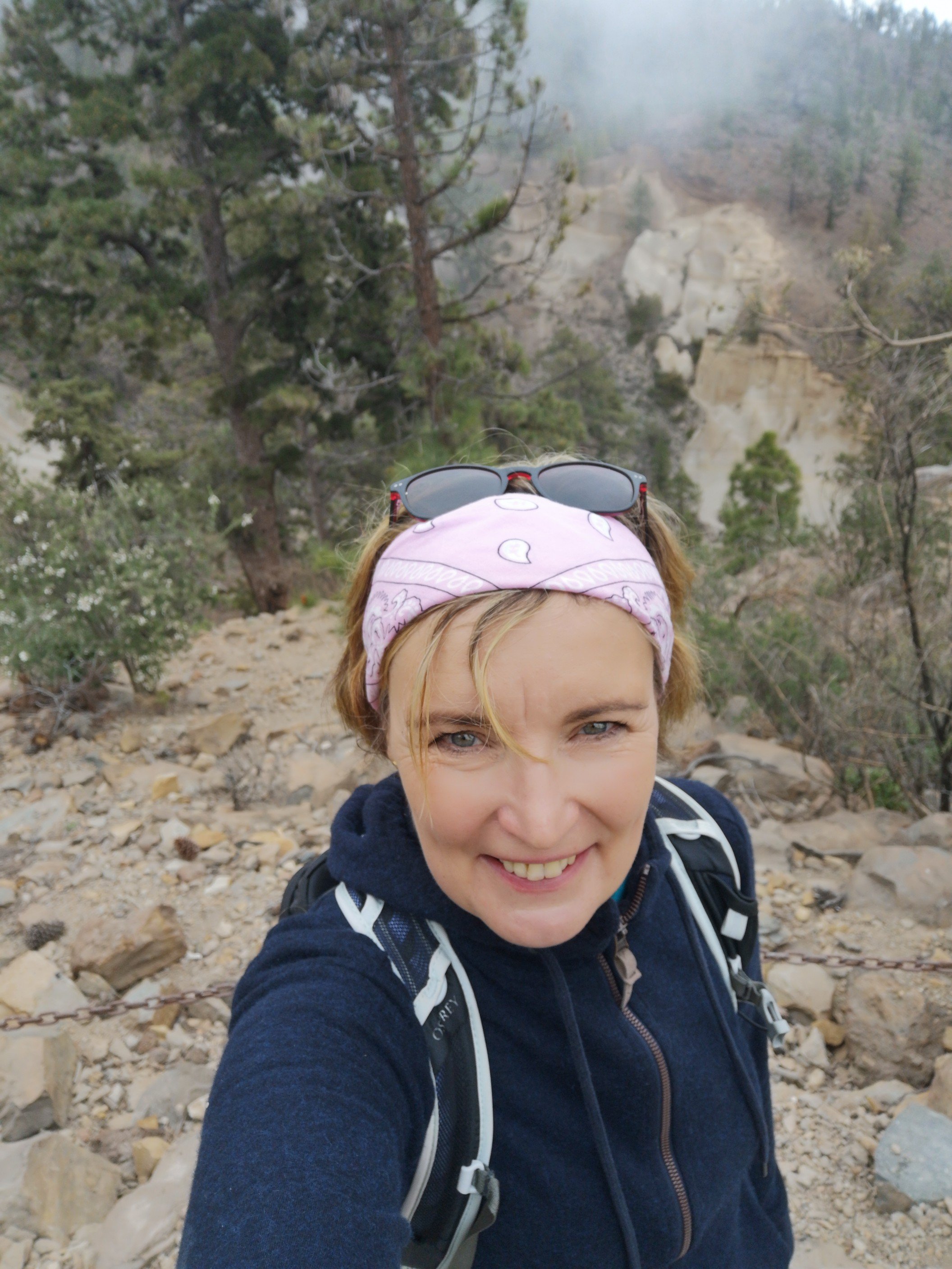
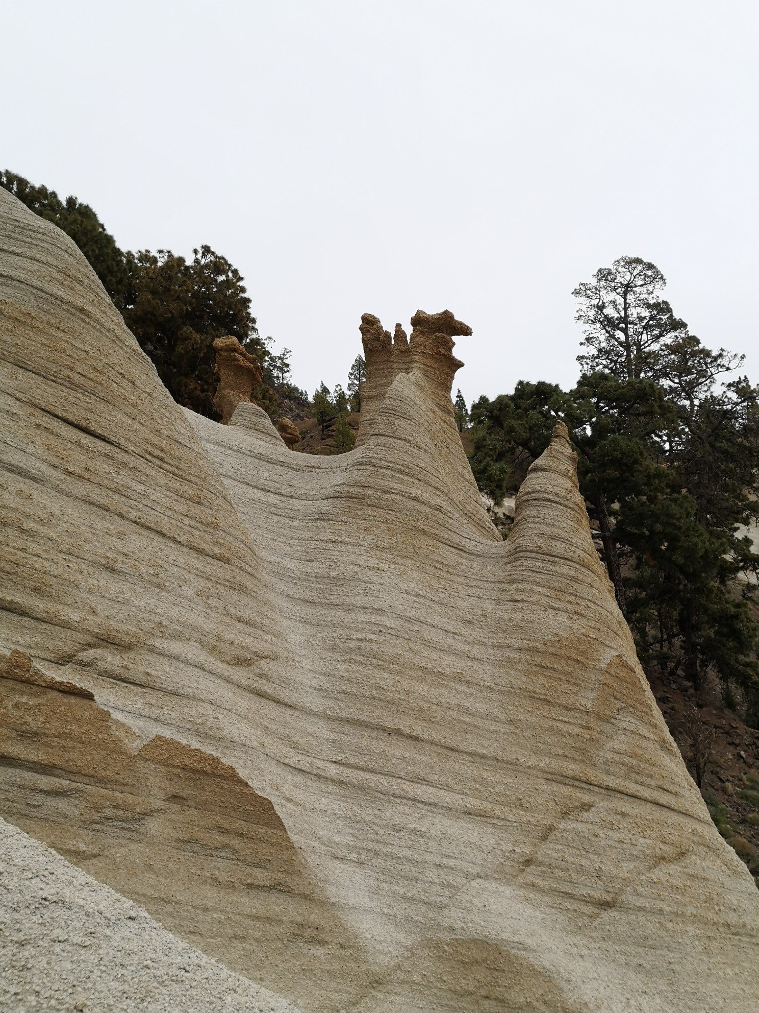
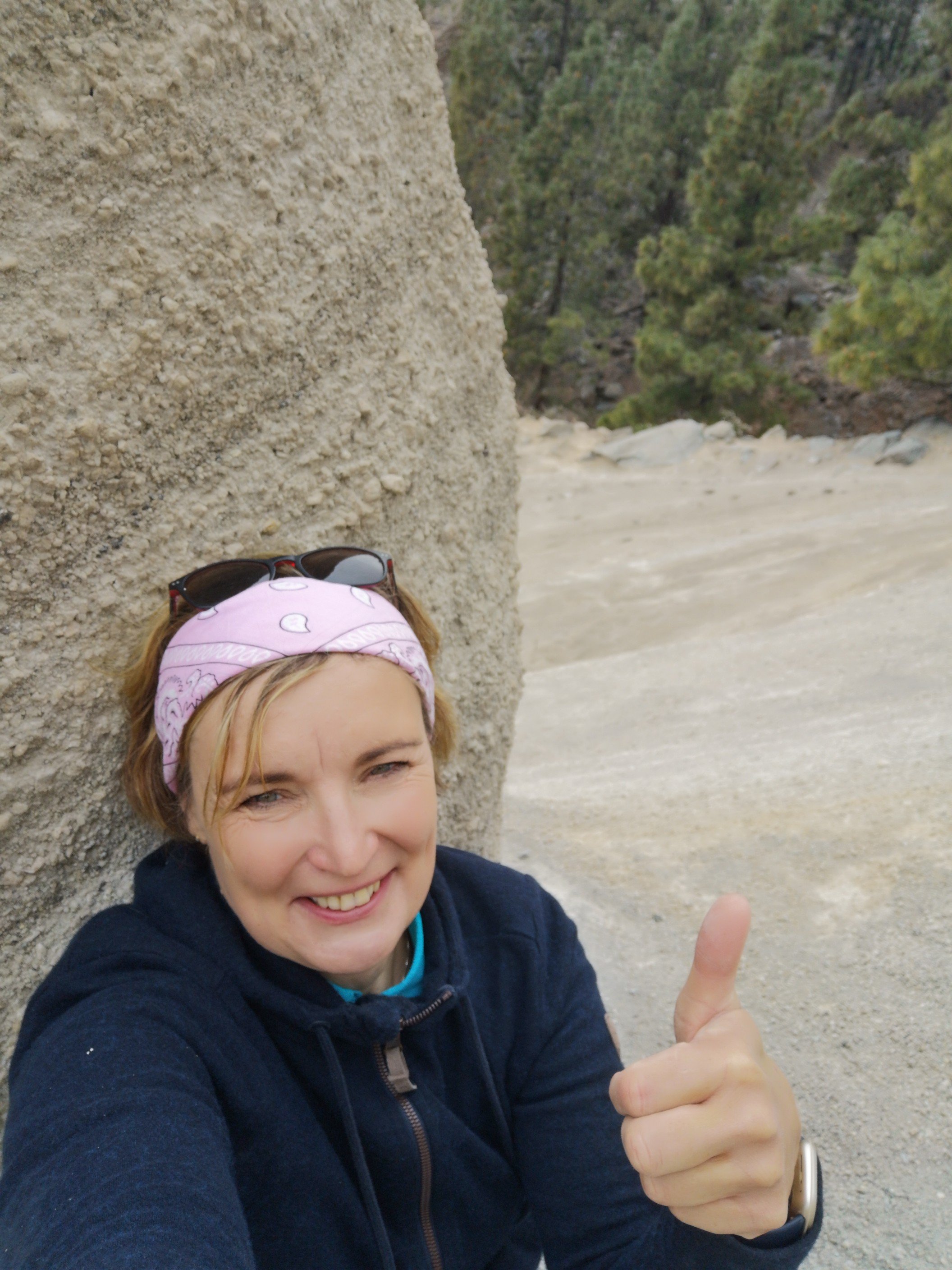
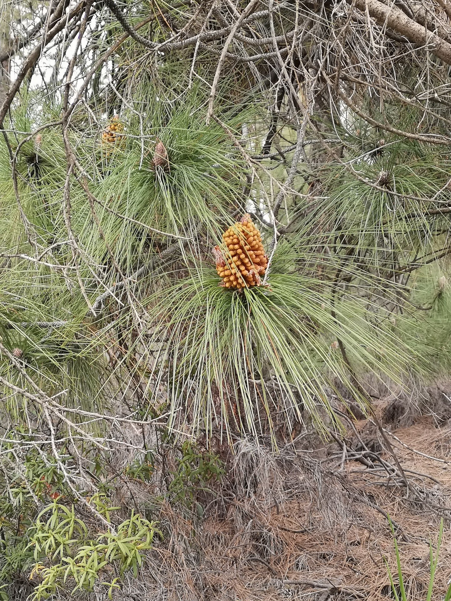
Bis zum Ziel sind es ca 7 km. Es ging den Camino steil und steinig hinauf. Er war breit, kein Abhang. Blauer Wanderweg. Da sollte doch eigentlich nichts passieren. Ich war nach diesem Fall besonders aufmerksam und schaute genau hin. Es waren nämlich wieder kaum Leute auf diesem Weg unterwegs. Ein paar Jogger kamen mir entgegen. Es ging durch einen lichten Pinienwald und der Boden war sehr vulkanisch. Der Aufstieg im Barranco war noch am anstrengendsten. Die Wege bis zum Paisajo schon fast langweilig. Ich konnte meinen Gedanken freien Lauf lassen: Was mache ich als nächstes? Verlängere ich nochmal um 3 Tage? Zwischendurch wurde fotografiert, gefilmt. Die erste Mondlandschaft en miniature erinnerte mich an die Nationalparks in Arizona. Und auch die richtige Paisaje sah aus wie der Bryce Canyon. Man kommt an einem Aussichtspunkt raus und hier war schon mehr los. So, und wie komme ich da runter? Wenn ich schon hier bin, möchte ich diese Sand-/ Gesteinsformationen auch mal anfassen und vom Nahen betrachten. Suche nach dem nächsten Weg! Schnitzeljagd geht weiter. Aber jetzt konnte man mal jemanden fragen und sich weiteren Wanderern anschließen.
It is about 7 km to the finish. The Camino was steep and stony. It was wide, no slope. Blue hiking path. Nothing was supposed to happen. I was particularly attentive after this one and looked closely. There were hardly any people on the path again. A few joggers came towards me. It went through a sparse pine forest and the ground was very volcanic. The climb up the Barranco was the most strenuous. The paths up to Paisajo were almost boring. I could let my thoughts run free: What do I do next? Do I extend it by another 3 days? In between, I took photos and filmed. The first miniature lunar landscape reminded me of the national parks in Arizona. And the real paisaje also looked like Bryce Canyon. You come out at a vantage point and there was more going on here. So, how do I get down there? While I’m here, I’d like to touch these sand/rock formations and look at them from up close. Search for the next path! Scavenger hunt continues. But now you could ask someone and join other hikers.
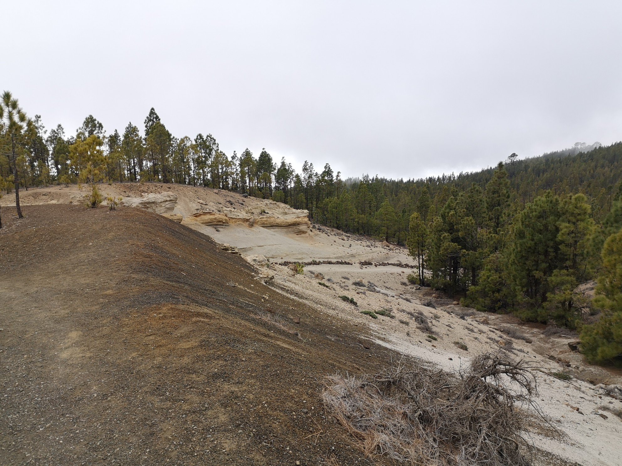
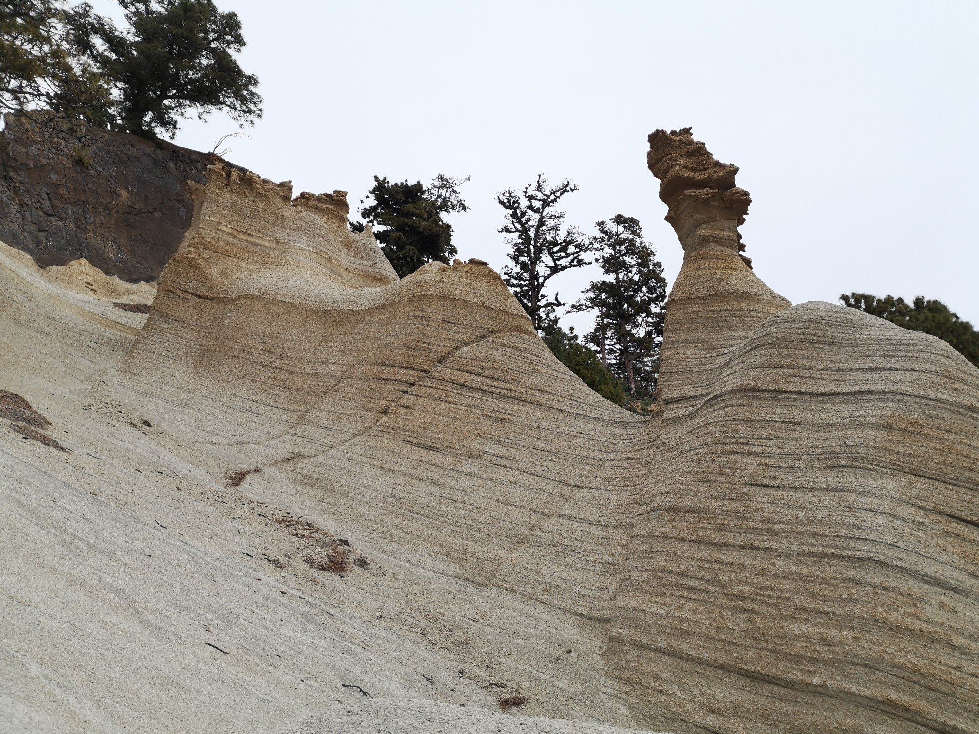
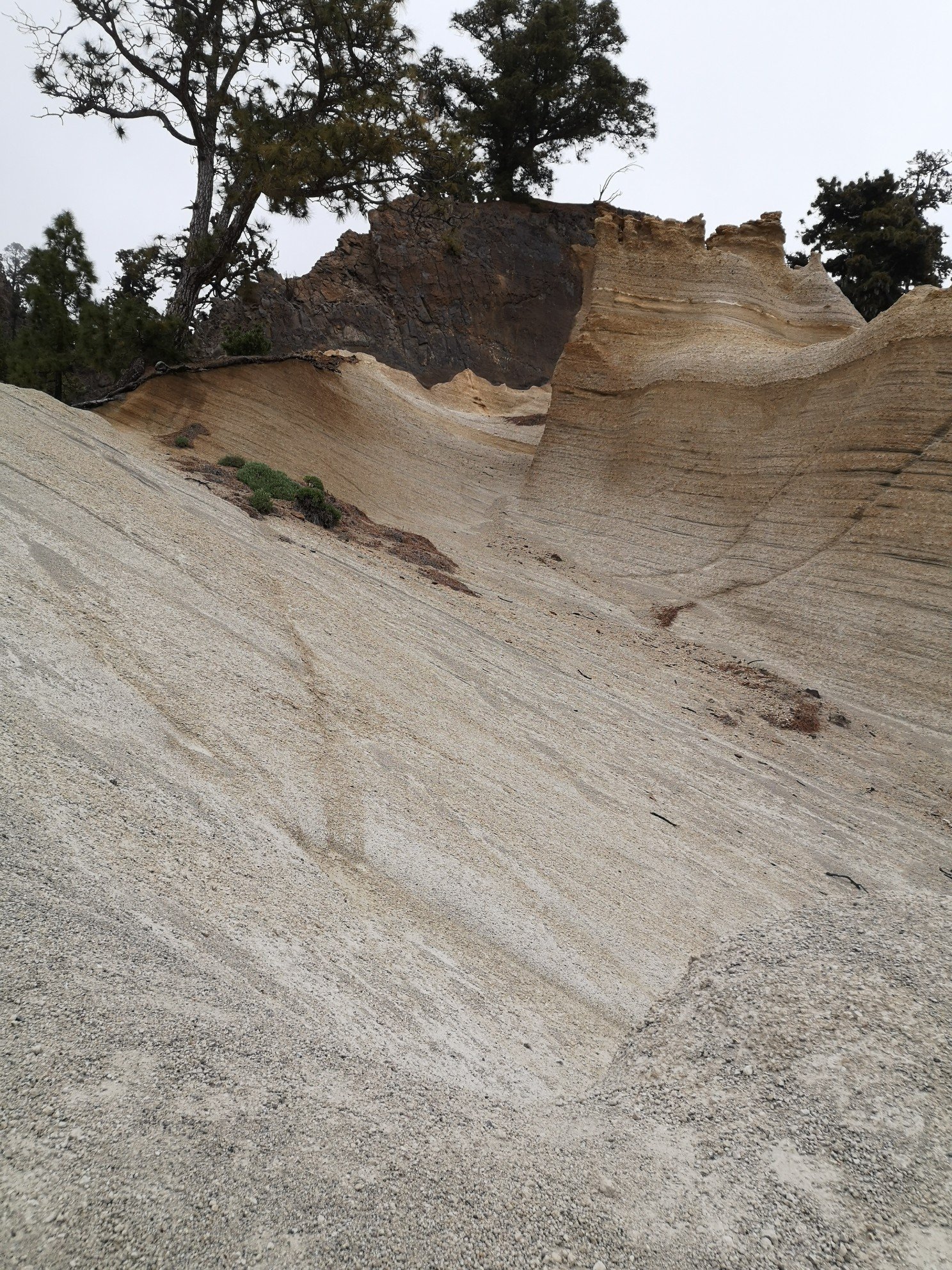
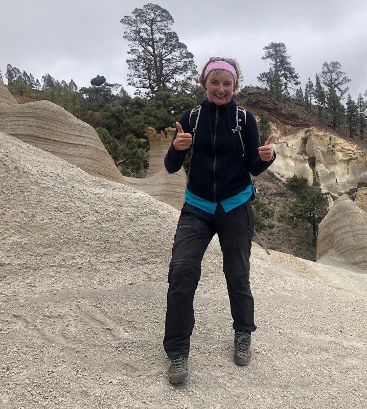
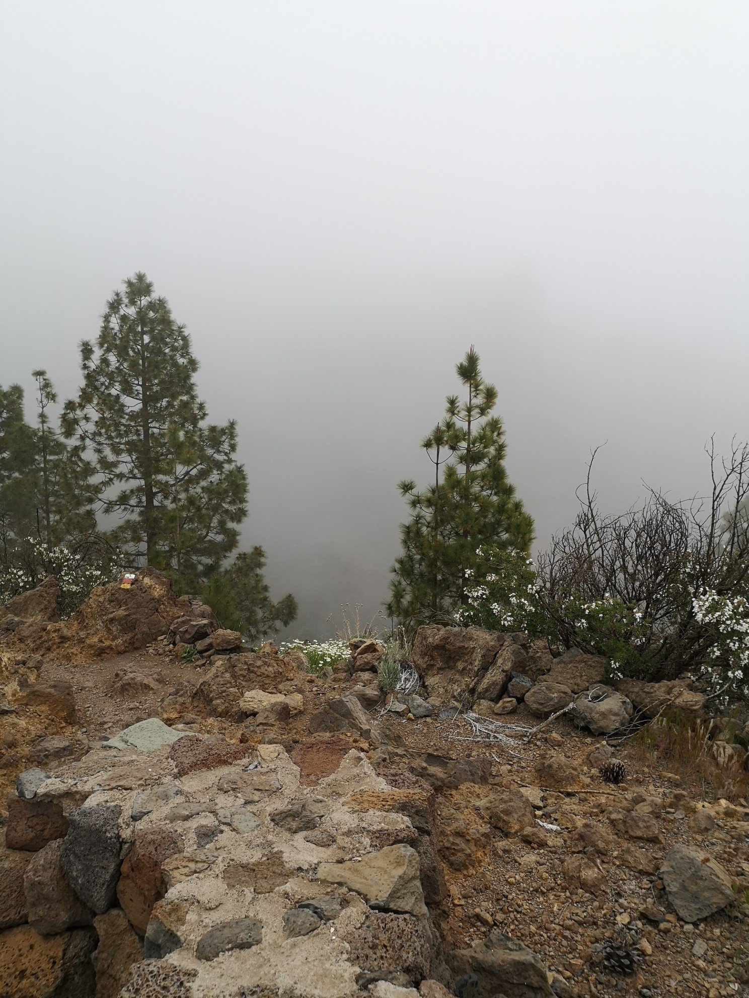
Man steht auf einem steilen Sandhang und muss aufpassen, nicht abzurutschen. Aber wenn man fällt, dann weich. Nicht wie ich auf die Steine. Nach 7 km Fußmarsch in ca 4 Stunden – Pause. Es war nur etwas windig da oben und ich trat dann auch bald den Rückweg an. Ich musste genauso viel wieder zurück. Es ging aber einen Rundweg entlang, so dass ich nicht den gleichen Weg in gesamter Länge zurück musste. Zurück geht ja auch meist schneller. Der Pfad war genauso langweilig wie der erste. Nur ein paar Sträucher, die in allen möglichen Farben blühten, konnten noch mein Interesse wecken. Eine Nebelwolke zog auf. Och nein, nicht regnen bitte!!! Hat sie gehört und ließ mich in Ruhe. Trotzdem war es bisschen gruselig durch den Nebelwald zu laufen. Vor mir lief ein einsamer Wanderer. So fühlte mich nicht ganz verlassen.
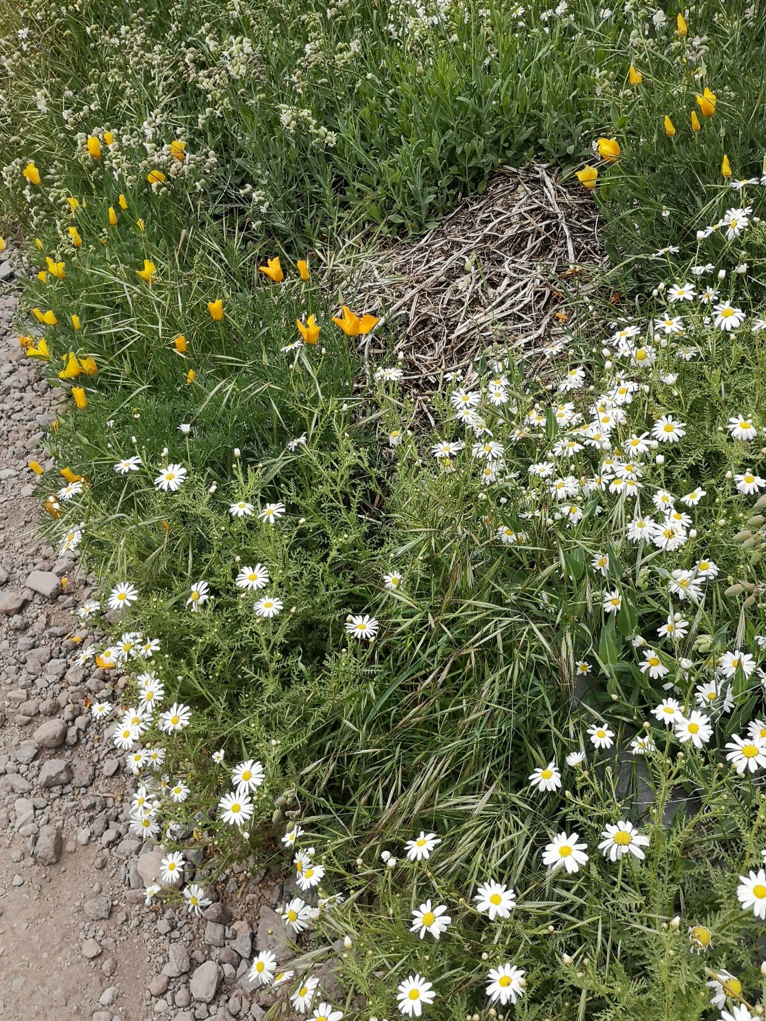
You stand on a steep sandy slope and have to be careful not to slip. But if you fall, you fall softly. Not like me on the stones. After 7 km of walking in about 4 hours – break. It was just a bit windy up there and I soon started the way back. I had to walk back. just as much. But it was a circular route, so I didn’t have to walk the same whole way back. Going back is usually quicker. The path was just as boring as the first one. Only a few bushes, which blossomed in all kinds of colours, could still arouse my interest. A cloud of fog came up. Oh no, don’t rain please!!! Heard it and left me alone. Still, it was a bit spooky walking through the cloud forest. There was a lone hiker walking in front of me. So I didn’t feel completely abandoned.
Für den Rückweg benötigte ich ca 2 Stunden. Im Vergleich zu 4 h für den Hinweg!!! Und ich ging nun den richtigen Weg zurück und musste nicht mehr suchen. Was lehrt mich das? Vertraue anderen Leuten nicht (Wanderbuch) und vergiss Google!!! Vertraue auf deinen eigenen Verstand und werde nicht gleich nervös und panisch, wenn es nicht weitergeht. Buch und Internet haben mich nur vom Wesentlichen abgelenkt.
It took me about 2 hours to get back. Compared to 4 h for the way there!!! And I now went back the right way and didn’t have to search anymore. What does this teach me? Don’t trust other people (hiking book) and forget Google!!!! Trust your own mind and don’t get nervous and panicky right away when it doesn’t go any further. The book and the internet only distracted me from the essentials.
Nun noch zwei Stunden Rückfahrt bis Puerto Cruz. Wo lang? Südliche oder nördliche Runde? Auto brachte mich nochmals ins nördliche Richtung am Teide vorbei. Immer noch im Sonnenschein. Ich hielt nur noch einmal an, um ein paar Fotos zu schießen. Vielleicht komme ich wieder. Aber wer weiß das schon? Auf der Abfahrt in Richtung Küste wurde es nochmal richtig nebelig. Nochmal konzentrieren nach diesem langen Tag. Ich habe es geschafft und bin ziemlich stolz: fast 18 km, wenn auch mit Hindernissen. So viel habe ich schon lange nicht mehr geschafft. Und morgen müssen die Beine eine Pause machen. Die Arme sind dran. Kayaking und Schnorcheln. Angeblich gibt es Delfine und Schildkröten zu sehen. Na schauen wir mal!!!
Now another two hours‘ drive back to Puerto Cruz. Which way? Southern or northern loop? Car took me north again past the Teide. Still in the sunshine. I stopped only once more to take a few photos. Maybe I will come again. But who knows? On the descent towards the coast, it got really foggy again. Concentrating again after this long day. I made it and am quite proud: almost 18 km, albeit with obstacles. I haven’t done that much in a long time. And tomorrow the legs have to take a break. It’s the arms‘ turn. Kayaking and snorkelling. Supposedly there are dolphins and turtles to see. Well, let’s see!!!

Hinterlasse einen Kommentar